A lava dammed lake is a fascinating natural feature created when flowing lava blocks the normal course of a river or stream, trapping water behind it to form a lake. This phenomenon combines the powerful forces of volcanism and hydrology, showcasing how molten rock can reshape landscapes dramatically. Understanding the formation of a lava dammed lake, as illustrated in a diagram, helps explain how volcanic activity can influence ecosystems, water flow, and long-term geological structures. Such diagrams are essential for geologists, students, and nature enthusiasts who want to visualize how these unique lakes are formed and sustained.
Understanding the Concept of a Lava Dammed Lake
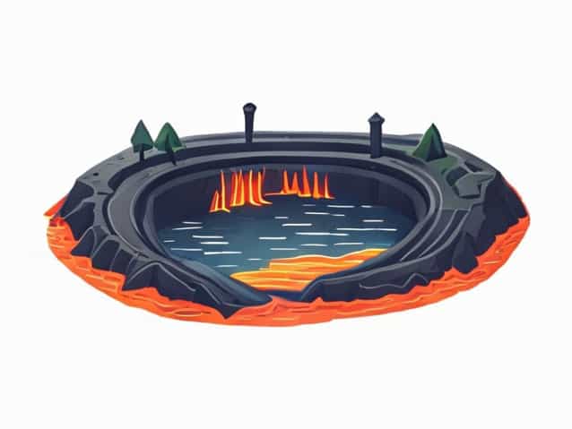
A lava dammed lake forms when lava from a volcanic eruption flows into a valley or river channel, hardens, and blocks the passage of water. Over time, water accumulates behind this natural barrier, creating a lake. Unlike artificial dams made by humans, lava dams are irregular and can be unstable, often subject to erosion or eventual collapse.
The concept can be visualized in adiagram of a lava dammed lake, which typically shows key features such as the original river valley, the lava flow that created the blockage, and the accumulating body of water. This visual representation provides an effective way to understand the dynamic process that shapes these lakes.
Main Components in a Diagram of a Lava Dammed Lake
A well-constructed diagram of a lava dammed lake typically includes several important elements that describe its formation and structure
- Volcanic VentThe source of the lava that flows into the valley.
- Lava FlowThe molten rock that moves through the landscape and eventually hardens.
- River ChannelThe pre-existing pathway where water used to flow before being blocked.
- Lava Barrier (Dam)The solidified lava that stops the river’s natural course.
- Lake BasinThe area behind the lava dam where water collects.
- Spillway or Overflow PointA location where water might eventually flow over the dam or erode it.
Each of these features contributes to understanding how a lava dammed lake develops, changes, and interacts with its surrounding environment. Diagrams often use color coding or arrows to show water movement, lava direction, and sediment deposition.
Formation Process of a Lava Dammed Lake
The formation of a lava dammed lake happens through several geological stages, which can be illustrated clearly in a diagram. These stages explain how volcanic activity reshapes existing landscapes and creates new water bodies.
1. Eruption and Lava Flow
The process begins with a volcanic eruption that releases molten rock, or lava. Depending on the volcano’s location and the surrounding topography, the lava can flow down valleys or along river paths. The temperature and viscosity of the lava determine how far it can travel before cooling.
2. Lava Blocking the River Valley
When the lava encounters a river or stream, it may spread across the water channel and eventually cool to form a solid rock wall. This newly formed barrier blocks the natural flow of water downstream. The height and width of the lava dam depend on the volume of the eruption and the speed of the lava flow.
3. Accumulation of Water
Once the river is obstructed, water begins to accumulate behind the lava dam. Over time, a lake forms as rainfall, snowmelt, and river inflow continue to add water. The size of the lake depends on the catchment area and the strength of the lava dam.
4. Stabilization and Erosion
As the lake grows, natural processes like erosion, sediment deposition, and chemical weathering begin to shape the area. Over thousands of years, the dam may erode, leading to either a controlled overflow or a catastrophic breach. Diagrams showing these stages often depict arrows representing erosion, sediment movement, and potential points of failure.
Examples of Lava Dammed Lakes Around the World
While relatively rare, lava dammed lakes can be found in several volcanic regions across the world. These natural formations serve as reminders of the planet’s geological power.
- Lake Llaima, ChileFormed by lava flows from the Llaima Volcano blocking a river valley in the Andes Mountains.
- Lake Mývatn, IcelandCreated by volcanic activity that reshaped northern Iceland’s landscape thousands of years ago.
- Crater Lake, Oregon (USA)Although technically formed by a collapsed volcano (a caldera), its formation process includes lava and water interaction similar to lava dammed lakes.
- Lake Kivu, AfricaThis lake lies in a tectonically active region with volcanic influences that have altered its hydrology through lava flows in the past.
In many geology textbooks and educational resources, diagrams of these lakes illustrate how topography, lava flow direction, and river systems interact to produce unique geographical structures.
Understanding the Role of a Diagram in Studying Lava Dammed Lakes
Adiagram of a lava dammed lakeserves as a powerful educational tool that simplifies complex geological processes. It allows viewers to see the interaction between volcanic activity and hydrological systems in a single, easy-to-understand image. Such diagrams often include both cross-sectional and top-down views to show elevation changes and water movement.
Benefits of Using Diagrams
- Helps visualize the relationship between lava flow and water accumulation.
- Clarifies the sequence of geological events leading to lake formation.
- Highlights the potential risks of dam failure or flooding.
- Assists in teaching geography, geology, and environmental science.
- Provides researchers with a conceptual model for field observations.
By studying diagrams, scientists can better predict how future volcanic eruptions might affect nearby river systems or create similar natural dams. For students, these visuals make it easier to connect theoretical concepts with real-world phenomena.
Risks and Environmental Impacts of Lava Dammed Lakes
While visually stunning, lava dammed lakes can also pose significant risks. Because the dams are naturally formed and irregular, they are often less stable than engineered structures. Over time, cracks or erosion may cause the dam to fail, releasing massive amounts of water suddenly and creating flash floods downstream.
Potential Risks Include
- FloodingSudden failure of the dam can lead to destructive floods.
- ErosionContinuous water flow weakens the dam structure over time.
- Sediment BuildupLakes behind lava dams often accumulate large amounts of sediment.
- Habitat ChangeFormation of new lakes can alter local ecosystems and displace wildlife.
Diagrams showing these risks typically illustrate stress points on the lava dam, sediment layers within the lake, and possible breach paths for escaping water. Such visuals are crucial in understanding the environmental implications of these natural structures.
How Scientists Study Lava Dammed Lakes
Geologists and hydrologists study lava dammed lakes through a combination of fieldwork, satellite imagery, and computer modeling. Diagrams play a vital role in summarizing findings, showing how lava dams evolve and interact with natural forces over time.
Key Methods Used in Research
- Field mapping of lava deposits and water flow paths.
- Radiometric dating to determine the age of the dam.
- Hydrological modeling to predict water pressure and flow stability.
- Geochemical analysis to understand lava composition.
- Remote sensing for long-term monitoring of erosion and sedimentation.
These studies help experts identify potential hazards, assess water quality, and understand the broader geological history of volcanic regions.
The formation of a lava dammed lake is a remarkable demonstration of how Earth’s internal and surface forces interact. A detaileddiagram of a lava dammed lakeoffers valuable insight into this process, showing the stages of lava flow, river blockage, water accumulation, and eventual stabilization. Through such visual aids, scientists and students alike can appreciate the dynamic relationship between volcanism and hydrology. These lakes, while beautiful, remind us of the planet’s constant transformation—shaped by fire, water, and time itself.