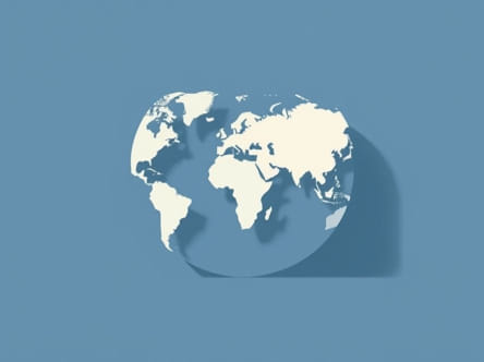
The Mercator projection has been one of the most widely used map projections in history, especially for navigation. Developed by Gerardus Mercator in 1569, it was originally designed to aid sailors in plotting straight-line courses over long distances. However, despite its usefulness for certain purposes, the Mercator projection has been criticized for distorting the shapes and sizes of landmasses. To understand whether the Mercator projection distorts shape, it’s essential to examine how this projection works and what compromises it makes in representing a three-dimensional Earth on a two-dimensional surface.
Understanding the Mercator Projection
How the Mercator Projection Works
The Mercator projection is a cylindrical map projection. Imagine wrapping a cylinder around the Earth, touching the equator, and projecting the surface of the globe onto that cylinder. When the cylinder is unrolled into a flat map, the resulting image represents lines of latitude and longitude as straight, perpendicular lines. This design is particularly useful for marine navigation because any straight line on the map corresponds to a constant compass bearing.
Mathematical Transformation
To create a Mercator map, the globe’s latitude lines are stretched increasingly as they approach the poles. This stretching ensures that angles and directions are preserved a quality known as conformality. The price of this angular accuracy, however, is significant distortion of both shape and area, especially near the poles.
Does the Mercator Projection Distort Shape?
Preservation of Local Shapes
The Mercator projection is conformal, which means it preserves local shapes and angles. Small regions on the map look correct in terms of their shape, making it suitable for navigational or local mapping purposes. This preservation is useful for specific tasks where accurate bearings are more important than spatial proportion.
Global Distortion of Shape
While local shapes are preserved, the Mercator projection distorts global shapes. The further from the equator a region is, the more stretched and exaggerated its appearance becomes. Countries and continents near the poles appear much larger and distorted compared to their actual size and shape on the globe. For example
- Greenland appears nearly the size of Africa, even though Africa is about 14 times larger.
- Alaska seems comparable to Brazil, though Brazil is significantly bigger and closer to the equator.
- Antarctica spans the entire bottom of the map, appearing massive and undefined in shape.
These exaggerations are not just size issues they also affect the viewer’s perception of the true shape of continents and countries. What appears rectangular or elongated on a Mercator map may be more compact or curved in reality.
Why Shape Distortion Happens
Flattening a Sphere
The Earth is a three-dimensional sphere, and any attempt to represent it on a two-dimensional surface inevitably introduces distortion. There is no perfect map projection. Every projection must compromise between accuracy in area, shape, distance, and direction. The Mercator projection chooses to preserve angles and direction, which means it must distort other properties most notably, shape and area at global scales.
Polar Expansion
The stretching effect of the Mercator projection becomes more severe as you move toward the poles. In fact, the poles themselves cannot be shown on a Mercator map because they would require infinite expansion. This results in high-latitude landmasses appearing far larger and more misshapen than they actually are.
Implications of Shape Distortion
Educational Misconceptions
One major criticism of the Mercator projection is that it can mislead people about the true shape and relative size of countries. This is particularly problematic in educational settings, where Mercator maps are often used in classrooms. Students may grow up with a skewed sense of geography, believing that Europe and North America are larger or more central than they really are, while countries near the equator especially in Africa and South America are undervalued in size and shape.
Cultural and Political Bias
The use of Mercator maps in global contexts has been interpreted by some as reinforcing Eurocentric or Western-centric worldviews. Larger representations of Europe, North America, and Russia may subconsciously influence perceptions of importance or dominance. As a result, many educators and geographers advocate using alternative projections that offer a more balanced visual representation of global geography.
Alternative Projections to Reduce Distortion
Several map projections have been developed to address the shape and size distortions of the Mercator projection. These include
- Gall-Peters ProjectionPreserves area but distorts shape. Continents look stretched vertically, especially near the equator.
- Robinson ProjectionOffers a compromise between shape and area distortion, providing a more visually balanced view of the world.
- Winkel Tripel ProjectionUsed by the National Geographic Society, it minimizes three kinds of distortion area, direction, and distance.
Each of these alternatives still has limitations, but they may better reflect the true proportions and shapes of landmasses on a global scale.
When Is the Mercator Projection Still Useful?
Marine Navigation
The primary strength of the Mercator projection remains in maritime and aeronautical navigation. Because it preserves angles, navigators can draw straight lines (called rhumb lines) to chart courses using a consistent compass bearing. This makes the Mercator map an essential tool for long-distance travel planning across oceans.
Local Mapping
In smaller regions where the distortion is minimal, such as cities or local topographical maps, the Mercator projection is still very practical. Local shapes and directions remain accurate enough for effective planning and navigation.
Web-Based Mapping Tools
Many online mapping services, including early versions of Google Maps, used the Mercator projection due to its simplicity and suitability for interactive scrolling and zooming. For local navigation and street-level detail, the distortion is usually negligible. However, for broader global views, more distortion-aware alternatives are increasingly being considered.
Yes, the Mercator projection does distort shape especially on a global scale and near the poles. While it preserves local angles and directions, which is beneficial for navigation and certain mapping tasks, it significantly alters the perceived shape and size of landmasses as one moves away from the equator. This distortion has both practical and cultural implications, making it important for map users and educators to understand its limitations. Alternative map projections offer more accurate representations of global geography in terms of shape and area, and choosing the right map depends on the specific goals of the user. By being aware of the Mercator projection’s strengths and weaknesses, we can use maps more responsibly and better appreciate the true layout of our world.