Jaunpur, a historic district located in the northern Indian state of Uttar Pradesh, is an area known for its rich cultural heritage, architectural landmarks, and agricultural significance. Spanning a substantial land area, Jaunpur encompasses diverse landscapes, including fertile plains, rivers, and urban settlements, all contributing to its economic and social importance. Understanding the total area of Jaunpur in square kilometers provides valuable insight into its geographic scope, population distribution, and regional planning needs. Covering both rural and urban environments, Jaunpur has been a site of historical events, religious significance, and evolving infrastructure, making it an important district within Uttar Pradesh.
Geographical Overview of Jaunpur
Jaunpur district is situated in the eastern part of Uttar Pradesh and lies within the fertile Gangetic plain. Its strategic location has historically made it a center of trade, culture, and governance. The total area of Jaunpur is approximately 4,031 square kilometers, which includes urban towns, agricultural fields, and rural villages. This area measurement helps in understanding population density, agricultural land use, and regional planning. The district is bordered by several other districts, including Varanasi to the southeast and Ghazipur to the east, creating a network of interlinked communities and economies.
Topography and Land Features
The topography of Jaunpur is characterized by flat plains, which are suitable for agriculture and settlement. The soil in the district is fertile, predominantly alluvial, allowing for the cultivation of crops such as wheat, rice, sugarcane, and pulses. Numerous small rivers and streams flow through Jaunpur, enhancing irrigation and supporting both agriculture and local water needs. The flat terrain also facilitates road and railway connectivity, making transportation of goods and people relatively efficient across the district.
Urban and Rural Distribution
Jaunpur’s 4,031 square kilometers include a mix of urban and rural areas. The urban centers, including the city of Jaunpur, house administrative offices, educational institutions, and commercial hubs. Rural areas make up the majority of the district, where agriculture remains the primary livelihood. Villages are often clustered around water sources and roads, with local markets serving as economic and social centers. This spatial distribution affects development planning, resource allocation, and public service delivery.
Population and Density
Understanding the area of Jaunpur in square kilometers also provides context for population studies. With a population exceeding 4 million residents, the district has a population density that reflects both urban concentration and rural dispersal. Urban centers tend to be densely populated due to administrative, educational, and commercial activities, while rural areas maintain a lower density. The combination of population figures and land area is crucial for planning infrastructure projects, healthcare facilities, schools, and transportation systems.
Administrative Significance
Jaunpur is divided into several administrative subdivisions, including tehsils and blocks, to effectively manage its large area of 4,031 square kilometers. These administrative divisions allow for localized governance, efficient delivery of public services, and implementation of development projects. Each tehsil manages multiple villages and towns, ensuring that the needs of residents across the district’s extensive land area are addressed. This system of governance is particularly important given the mixture of urban and rural regions within Jaunpur.
Agriculture and Land Use
The agricultural potential of Jaunpur is closely linked to its total area. Fertile plains and access to irrigation make the district a productive agricultural hub. Farmers cultivate a variety of crops depending on the season, soil type, and water availability. Rice and wheat are staple crops, while sugarcane and pulses contribute to both local consumption and trade. The extensive land area allows for crop rotation, livestock grazing, and other rural economic activities. Understanding the total area helps policymakers and agricultural planners optimize land use for maximum productivity and sustainability.
Infrastructure and Connectivity
Jaunpur’s geographical size also impacts infrastructure development. The district has a network of highways, railways, and local roads connecting its urban centers to rural villages. Efficient transportation is essential for moving agricultural products to markets, providing access to education and healthcare, and supporting industrial development. The area in square kilometers helps engineers and planners determine the scale and scope of infrastructure projects needed to serve both dense urban areas and sparsely populated rural zones.
Cultural and Historical Importance
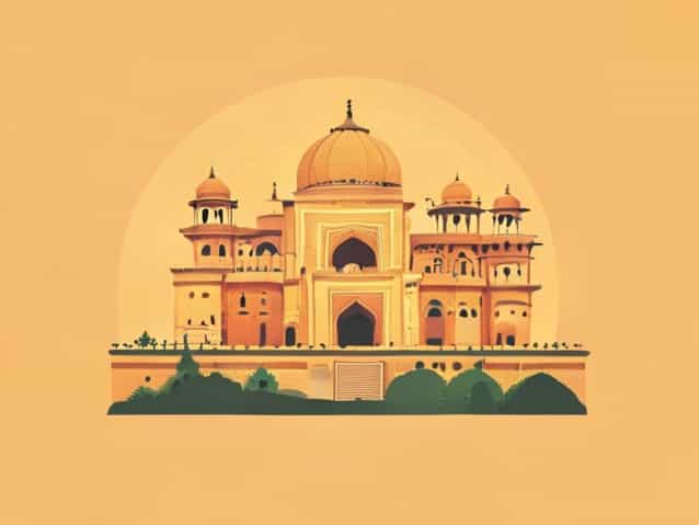
Beyond its physical size, Jaunpur covers an area rich in cultural and historical significance. The district is home to ancient monuments, mosques, temples, and traditional architecture that date back several centuries. These historical sites attract tourism, contributing to the local economy and fostering cultural preservation. The district’s area accommodates numerous heritage sites spread across urban and rural landscapes, reflecting the historical spread of settlements and architectural influence over time.
Environmental Considerations
With an area of over 4,000 square kilometers, environmental management is critical in Jaunpur. Conservation of water bodies, soil preservation, and sustainable agricultural practices are essential to maintain ecological balance. Forested patches and small wetlands within the district support biodiversity, providing habitats for local flora and fauna. Understanding the total area helps environmental agencies implement strategies for sustainable development, balancing human activity with natural conservation.
Education and Health Services
The size of Jaunpur in square kilometers directly influences the distribution of educational and healthcare facilities. Schools, colleges, and vocational institutions are concentrated in urban hubs, while primary schools and health centers serve rural populations. Policymakers use the land area to plan the location of new institutions to ensure accessibility for residents across the district. Healthcare services, in particular, must account for the travel distance in large rural areas, making area measurement a key factor in service planning.
Economic Activities
Jaunpur’s extensive land area supports diverse economic activities. Agriculture dominates the rural economy, while urban centers focus on trade, small-scale industries, and services. Markets, storage facilities, and industrial zones are strategically located to serve the population efficiently. Understanding the total area helps businesses and local authorities plan logistics, market access, and industrial development in a way that maximizes the use of available land.
The Jaunpur district, spanning approximately 4,031 square kilometers, is a region of great geographic, cultural, and economic importance. Its vast area encompasses fertile agricultural plains, historic towns, rural villages, and urban centers. By understanding its total area, one gains insight into population density, land use, infrastructure needs, and development planning. Jaunpur’s size also shapes its historical preservation, environmental management, and economic strategies. The district’s combination of cultural heritage, agricultural productivity, and urban development highlights the significance of its land area in shaping the lives of millions of residents.
From fertile farmlands to bustling city centers, Jaunpur’s 4,031 square kilometers represent a district that balances historical richness, economic vitality, and social diversity. Planning for infrastructure, health, education, and environmental sustainability all depend on an accurate understanding of the district’s geographic scope. By considering both its total area and the distribution of people, resources, and activities, policymakers and residents alike can ensure the continued growth and prosperity of Jaunpur, maintaining its status as an essential region in Uttar Pradesh.
Overall, Jaunpur’s area in square kilometers is more than just a number; it reflects the physical space within which the district’s history, culture, and economy unfold. The knowledge of its area informs decision-making, supports sustainable development, and helps preserve the heritage and livelihood of its people, making Jaunpur a unique and significant district within northern India.