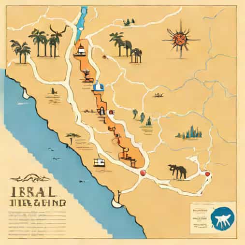
The map of Israelite journey to the Promised Land is an important concept for understanding one of the most significant narratives in biblical history. This journey describes the long movement of the Israelites from slavery in Egypt through the wilderness and finally toward the land promised to them. While the story is often told through scripture, maps help readers visualize the geographical path, key locations, and challenges faced along the way. Understanding this journey provides cultural, historical, and spiritual context that continues to influence religious thought and education today.
Understanding the Purpose of the Israelite Journey Map
A map of the Israelite journey to the Promised Land is not just a geographic tool. It represents a timeline of events, decisions, struggles, and transformations. The route highlights places where important moments occurred, such as miracles, laws given, rebellions, and leadership transitions.
These maps are often used in education, religious study, and historical exploration to help readers follow the movement described in ancient texts. They give structure to a story that spans many years and large regions.
Why Mapping the Journey Matters
- Helps visualize long-distance travel in the ancient world
- Clarifies the sequence of key events
- Connects geography with historical narrative
- Supports deeper understanding of cultural context
Starting Point Life in Egypt
The journey begins in Egypt, where the Israelites lived for generations. According to tradition, they were eventually enslaved and forced into hard labor. Egypt, located along the Nile River, was a powerful and advanced civilization at the time.
On a map, Egypt serves as the western starting point of the journey. The departure from Egypt marks a major turning point, symbolizing liberation and the beginning of a long transformation.
Geographical Importance of Egypt
Egypt’s fertile land made it suitable for settlement, but its distance from the Promised Land required crossing deserts and unfamiliar territories. Mapping this region helps explain why the journey was difficult and required careful navigation.
The Route Through the Wilderness
After leaving Egypt, the Israelites traveled through a region often referred to as the wilderness or desert. A map of the Israelite journey to the Promised Land usually shows several stages through this harsh environment.
This wilderness area included deserts, mountains, and valleys, each presenting different challenges. Travel was slow, resources were limited, and survival required cooperation and leadership.
Key Wilderness Areas Often Shown on Maps
- The Wilderness of Shur
- The Wilderness of Sin
- The Wilderness of Paran
- The Sinai Peninsula
Each of these locations is associated with important events and lessons. Maps help place these areas in relation to one another, making the narrative easier to follow.
Mount Sinai and Its Central Role
One of the most significant locations on the map of the Israelite journey to the Promised Land is Mount Sinai. This mountain is often shown prominently because of its importance in the story.
At Mount Sinai, the Israelites are described as receiving laws that would guide their community. The mountain represents a spiritual and moral foundation rather than just a geographic point.
Why Mount Sinai Is Central on Journey Maps
- It marks a long توقف (stop) in the journey
- It represents a covenant moment
- It serves as a reference point for later travel
- It connects geography with belief systems
Movement Through the Desert Regions
After leaving Mount Sinai, the journey continues through desert regions that are often marked on maps with various campsites. These stops illustrate the long and winding nature of the path.
Rather than a straight line, the map shows a route with many turns and pauses. This reflects years of travel rather than a short expedition.
Why the Route Was Not Direct
Several explanations are often given for the indirect route. These include the need to avoid hostile territories, logistical challenges, and internal struggles within the group. Maps help visualize how indirect the path truly was.
- Avoidance of heavily fortified regions
- Limited access to water sources
- Long periods of encampment
- Gradual movement across terrain
Key Locations East of the Jordan River
As the journey neared its end, the Israelites approached areas east of the Jordan River. These locations are often clearly labeled on maps because they mark the transition toward the Promised Land.
The plains near the Jordan River became a staging area before entering the land that lay ahead. This region allowed the people to prepare for settlement and future challenges.
Importance of the Jordan River Region
The Jordan River serves as a natural boundary on many maps of the Israelite journey. Crossing it symbolizes completion of the long journey and the beginning of a new chapter.
- Represents transition and change
- Marks the edge of the Promised Land
- Appears frequently in historical references
How Maps Help Interpret the Promised Land
The Promised Land itself is usually shown as a defined territory west of the Jordan River. Maps often highlight surrounding regions to provide context, including neighboring peoples and natural boundaries.
Understanding the geography helps explain later settlement patterns and conflicts. It also helps readers see how the journey connects to later historical developments.
Geographic Features Commonly Shown
- Rivers and valleys
- Mountain ranges
- Desert areas
- Ancient cities and routes
Educational Value of Studying the Journey Map
Studying a map of the Israelite journey to the Promised Land is valuable for students, teachers, and readers interested in history or religion. It transforms abstract stories into understandable movements across real terrain.
Maps help learners connect narrative events with physical locations, improving memory and comprehension. They also encourage curiosity about ancient geography and cultures.
How Maps Support Learning
- Visualize complex journeys
- Clarify timelines and sequences
- Support historical interpretation
- Encourage deeper engagement
Symbolic Meaning Reflected Through Geography
Beyond physical travel, the map of the Israelite journey to the Promised Land also carries symbolic meaning. The long route through difficult terrain represents growth, testing, and transformation.
Many readers interpret the journey as a metaphor for personal or communal development. The changing landscapes mirror internal struggles and progress over time.
Symbolic Themes Commonly Associated
- Freedom after hardship
- Faith during uncertainty
- Patience and endurance
- Hope for fulfillment
The map of the Israelite journey to the Promised Land offers more than a simple geographical outline. It provides insight into history, culture, belief, and human experience. By tracing the route from Egypt through the wilderness and toward the Jordan River, readers gain a clearer understanding of the challenges and meaning behind the journey. Whether used for education, study, or personal reflection, this map remains a powerful tool for visualizing one of the most influential journeys ever recorded.