The map of Latin America is a fascinating representation of a diverse and culturally rich region that spans from the northern borders of Mexico down to the southern tip of South America. This area includes a variety of countries, territories, and landscapes, each with its own unique geography, history, and cultural identity. Understanding the map of Latin America is crucial not only for geographical knowledge but also for comprehending the economic, political, and social dynamics that influence the region. From the towering Andes mountains to the Amazon rainforest and the vibrant cities along the coasts, the map of Latin America provides a window into one of the most diverse parts of the world.
Geographical Overview
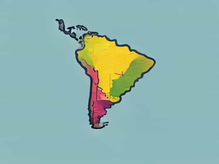
Latin America is composed of countries in both North and South America where Romance languages, primarily Spanish and Portuguese, are spoken. The region is typically divided into several subregions Central America, South America, and the Caribbean. Each subregion has distinct geographical features, climates, and natural resources, making the map of Latin America an essential tool for understanding these differences. The region covers a vast area, stretching from the deserts of northern Mexico to the icy expanses of Patagonia in southern Argentina and Chile.
Subregions of Latin America
- Central AmericaIncludes countries such as Guatemala, Honduras, Nicaragua, Costa Rica, and Panama. It is characterized by mountainous terrain, tropical rainforests, and coastlines along both the Pacific Ocean and the Caribbean Sea.
- South AmericaHome to large countries such as Brazil, Argentina, and Colombia. South America features the Andes Mountains, the Amazon Basin, vast plains like the Pampas, and the Atacama Desert.
- The CaribbeanConsists of island nations like Cuba, the Dominican Republic, and Puerto Rico, known for their tropical climate, beaches, and volcanic landscapes.
Political and Cultural Divisions
The map of Latin America also reflects political boundaries and cultural distinctions. Each country has its own government, economic system, and cultural heritage, influenced by indigenous civilizations, European colonization, and African heritage. Spanish and Portuguese are the dominant languages, but numerous indigenous languages are still spoken, particularly in countries like Bolivia, Peru, and Guatemala. The map helps illustrate the complex tapestry of nations, ethnic groups, and cultures that coexist in Latin America.
Important Countries and Capitals
- Mexico Capital Mexico City
- Brazil Capital Brasília
- Argentina Capital Buenos Aires
- Colombia Capital Bogotá
- Chile Capital Santiago
- Peru Capital Lima
- Cuba Capital Havana
Major Geographical Features
One of the most striking aspects of the map of Latin America is the diversity of geographical features. The region includes mountains, rivers, deserts, rainforests, and coastlines. Understanding these features is essential for appreciating the environment, natural resources, and challenges faced by the countries within the region.
Mountains and Highlands
The Andes Mountains, running along the western coast of South America, are the longest continental mountain range in the world. They influence climate patterns, agriculture, and settlement patterns in countries such as Chile, Peru, and Ecuador. Central America also has volcanic mountain ranges that are significant both ecologically and historically.
Rivers and Water Systems
The Amazon River is the largest river system in Latin America and the world by discharge volume, flowing through Brazil, Peru, Colombia, and several other countries. Other major rivers include the Paraná, Orinoco, and Magdalena, which are vital for transportation, agriculture, and biodiversity.
Deserts and Plains
Latin America contains some of the driest and most arid regions, such as the Atacama Desert in northern Chile and southern Peru. In contrast, fertile plains like the Pampas in Argentina and Uruguay support extensive agriculture and cattle ranching, playing a crucial role in the economy.
Forests and Biodiversity
The Amazon Rainforest, often referred to as the lungs of the Earth, covers much of northern Brazil and extends into several neighboring countries. The map of Latin America highlights this vast forest, which is home to unparalleled biodiversity, including thousands of plant and animal species. Other significant forests include the Atlantic Forest in Brazil and the cloud forests in Central America.
Economic and Strategic Significance
The map of Latin America is not only a guide to geography but also to economic resources and strategic locations. The region is rich in natural resources such as oil, gas, minerals, and agricultural products. Coastal areas are important for trade, ports, and tourism, while inland areas offer resources like coffee, soybeans, and timber. Understanding the map allows for insights into regional trade, economic partnerships, and geopolitical strategies.
Key Economic Areas
- Brazil Agriculture, mining, oil, and industry
- Mexico Manufacturing, oil, and tourism
- Chile Copper mining and wine production
- Argentina Agriculture, beef, and soy exports
- Venezuela Oil reserves
Tourism and Cultural Sites
The map of Latin America also provides a framework for exploring the region’s cultural and tourist attractions. Historical cities, ancient ruins, natural wonders, and vibrant festivals are distributed throughout Latin America. Tourists use maps to plan trips to destinations like Machu Picchu in Peru, the Galapagos Islands in Ecuador, and the beaches of the Caribbean. Understanding the geography enhances the experience and appreciation of Latin American culture.
Notable Tourist Destinations
- Machu Picchu, Peru
- Christ the Redeemer, Brazil
- Patagonia, Argentina and Chile
- Cancun and Riviera Maya, Mexico
- Havana, Cuba
The map of Latin America serves as an essential tool for understanding one of the most diverse and dynamic regions in the world. It reveals geographical features such as mountains, rivers, deserts, and forests, as well as political boundaries, cultural regions, and economic zones. By studying the map, one gains insight into the natural resources, population distribution, cultural heritage, and strategic importance of Latin America. Whether for educational purposes, travel planning, or understanding economic and environmental issues, the map of Latin America provides a comprehensive view of a region that continues to shape global culture, politics, and economies.