Laurasia was one of the two supercontinents that formed after the breakup of the ancient supercontinent Pangaea during the late Paleozoic and early Mesozoic eras. It played a crucial role in shaping the current arrangement of continents on Earth. Understanding which land masses resulted from Laurasia helps geologists, paleontologists, and students of Earth’s history trace the evolution of continents, climate patterns, and biodiversity over millions of years. The study of Laurasia provides insight into plate tectonics, continental drift, and how ancient landmasses influenced modern geography.
Formation of Laurasia
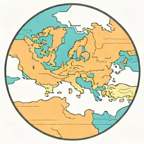
Laurasia was formed approximately 200 million years ago after the breakup of Pangaea, a supercontinent that existed during the late Paleozoic and early Mesozoic eras. Pangaea split into two large landmasses Laurasia in the northern hemisphere and Gondwana in the southern hemisphere. Laurasia included large areas that would eventually become the continents of North America, Europe, and Asia (excluding India). The breakup of Pangaea and the formation of Laurasia marked the beginning of a significant rearrangement of Earth’s landmasses, setting the stage for modern continental configurations.
Characteristics of Laurasia
- Located primarily in the Northern Hemisphere
- Comprised of what are now North America, Europe, and parts of Asia
- Experienced diverse climates ranging from tropical to temperate zones
- Hosted a wide variety of flora and fauna during the Mesozoic era
Laurasia’s geographical position influenced ocean currents, climate, and the evolution of life on its landmasses, making it a key factor in Earth’s geological history.
Breakup of Laurasia
Laurasia did not remain a single, unified landmass indefinitely. Over millions of years, tectonic activity caused it to fragment into smaller continents. The breakup of Laurasia was gradual, occurring during the Mesozoic era, and it resulted in the formation of several modern landmasses. This process was driven by plate tectonics, where the movement of the Earth’s lithospheric plates caused the landmasses to drift apart, forming oceans, mountain ranges, and distinct continental regions.
Factors Leading to Fragmentation
- Movement of tectonic plates due to mantle convection
- Formation of rift zones and mid-ocean ridges
- Volcanic activity and the creation of new crust
- Seafloor spreading that expanded the Atlantic Ocean
The fragmentation of Laurasia eventually shaped the continents as we know them today, influencing their geological features and biodiversity patterns.
Modern Landmasses Resulting from Laurasia
The landmasses that directly resulted from the breakup of Laurasia include North America, Europe, and Asia (excluding the Indian subcontinent and some adjacent regions). Each of these landmasses experienced further tectonic activity, leading to the development of mountains, basins, and other geological structures that define their current topography.
North America
North America was one of the primary landmasses formed from Laurasia. During the breakup, it drifted westward, forming the Atlantic Ocean along its eastern boundary. Geological evidence shows that ancient mountain ranges, such as the Appalachian Mountains, were already present before the complete separation. North America continued to evolve with the formation of the Rocky Mountains, Great Plains, and various plateaus, resulting in the diverse landscapes observed today.
Europe
Europe also originated from the northern section of Laurasia. As Laurasia fragmented, Europe gradually separated from North America, forming the North Atlantic Ocean. Europe’s geology reflects the collision and rifting events that occurred during and after the breakup. Mountain ranges like the Alps and the Pyrenees were shaped by these tectonic interactions, while sedimentary basins and plains formed as Europe stabilized over millions of years. Today, Europe’s landmass includes a variety of geological features inherited from its Laurasian origins.
Asia
Asia, particularly the northern and eastern regions, was another major landmass derived from Laurasia. The continent grew through the accretion of smaller terranes and islands over time. Plate tectonic movements caused the formation of mountain ranges such as the Urals, Himalayas, and other highlands. Although India was part of Gondwana, Asia’s northern and eastern sections were influenced by Laurasia, leading to the diverse geography, climate zones, and ecosystems that define the continent today.
Smaller Landmasses
In addition to the major continents, several smaller land areas also originated from Laurasia. These include Greenland and parts of the Arctic islands. Greenland drifted northwest from the main Laurasian landmass, creating distinct geological and climatic conditions. Arctic islands and smaller continental fragments also separated during tectonic shifts, contributing to the complex arrangement of the northern hemisphere’s landmasses.
Importance of Laurasia in Geological Studies
Studying Laurasia is essential for understanding Earth’s geological history and plate tectonics. By analyzing rock formations, fossil distributions, and structural geology, scientists can reconstruct the positions of ancient landmasses. This knowledge helps in predicting natural resource locations, understanding past climate patterns, and tracing the evolutionary history of plants and animals that once inhabited Laurasia.
Fossil Evidence
- Fossils of similar species found in North America, Europe, and Asia support the existence of Laurasia
- Marine fossils indicate the presence of ancient shallow seas connecting landmasses
- Plant fossils reveal climate conditions and the spread of flora across Laurasia
Geological Features
- Mountain ranges like the Appalachians and Urals formed during Laurasia’s assembly and fragmentation
- Rock strata align across continents, confirming past connections
- Mineral deposits and fossil fuels often correspond to Laurasia’s ancient geography
Laurasia played a pivotal role in the formation of modern continents in the Northern Hemisphere. The breakup of this ancient supercontinent resulted in the creation of North America, Europe, Asia (excluding India), Greenland, and several Arctic islands. Studying Laurasia allows scientists to understand continental drift, plate tectonics, and the geological evolution of Earth. Its legacy continues to influence the distribution of landmasses, mountain ranges, and ecosystems across the northern hemisphere. By exploring Laurasia’s history, we gain insight into how Earth’s continents have shifted and evolved over hundreds of millions of years, shaping the world we inhabit today.